A dust storm warning and severe thunderstorm watch have been issued for parts of the Chicago area as heavy winds are contributing to diminished visibilities ahead of potential storms.
The dust storm warnings were issued in several counties across the Chicago area.
The warnings remain in effect until 8 p.m. for Kendall, northern LaSalle, northwestern Will, and southern DeKalb in Illinois, as well as Porter and Lake counties in northwest Indiana.
Kane, Cook, DuPage, southeastern DeKalb counties were added to the warning until 8:30 p.m.
Officials warned of “life-threatening travel” at the following locations:
- I-39 between mile markers 66 and 77
- I-55 between mile markers 250 and 269
- I-57 between mile markers 339 and 358
- I-80 between mile markers 124 and 155
- I-90 between mile markers 104 and 107
- I-94 between mile markers 62 and 74
- I-294 between mile markers 62 and 74
- I-355 between mile markers 1 and 14
- Indiana I-80 between mile markers 1 and 16
- Indiana I-90 between mile markers 1 and 37
- Indiana I-94 between mile markers 16 and 32
- Indiana I-65 between mile markers 254 and 261
- I-55 between mile markers 270 and 294
- I-88 between mile markers 96 and 140
- I-90 between mile markers 42 and 103
- I-94 between mile markers 26 and 61
- I-290 between mile markers 1 and 29
- I-294 between mile markers 26 and 61
- I-355 near mile marker 12, and between mile markers 15 and 30
Meanwhile, a severe thunderstorm watch issued for Grundy and Kankakee counties in Illinois and Jasper and Newton counties in northwest Indiana has been canceled.
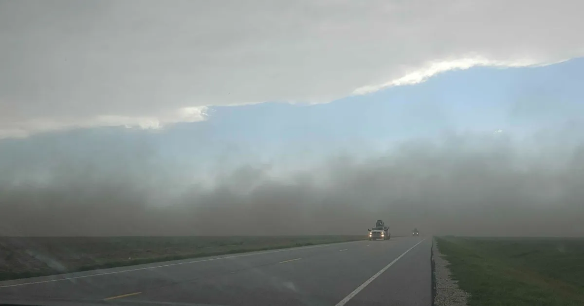
The National Weather Service warns of localized visibility dropping below one mile with winds howling between 20 and 30 miles per hour, with gusts of up to 50 miles per hour expected.
Startling images and videos captured a wild scene in parts of Illinois where massive dust clouds could be seen as warnings were issued in several counties, including parts of the Chicago area. (Courtesy: Stephanie Alderson Heppe in Normal, Illinois)
Those gusts are possible area-wide, with a wind advisory in effect until 12 a.m. as officials warn of possible downed tree limbs and power outages in wake of the winds.
In the far south parts of the Chicago area, those winds could be accompanied by severe storms, with damaging winds and hail the primary threat with any storms that may develop there.
The active weather comes ahead of a significant cooldown across the area, whiplashing from Thursday’s record heat to highs back in the mid 60s this weekend.
Temperatures are expected to continue to drop from there, with forecasted highs in the mid 50s early next week along with more chances of rain.