LINCOLN, Neb. (KOLN) – A strong cold front will bring the potential for strong to severe storms to parts of eastern Nebraska into Thursday evening. A Tornado Watch is in place for parts of central and eastern Nebraska – including the Lincoln and Omaha metros – until midnight tonight.
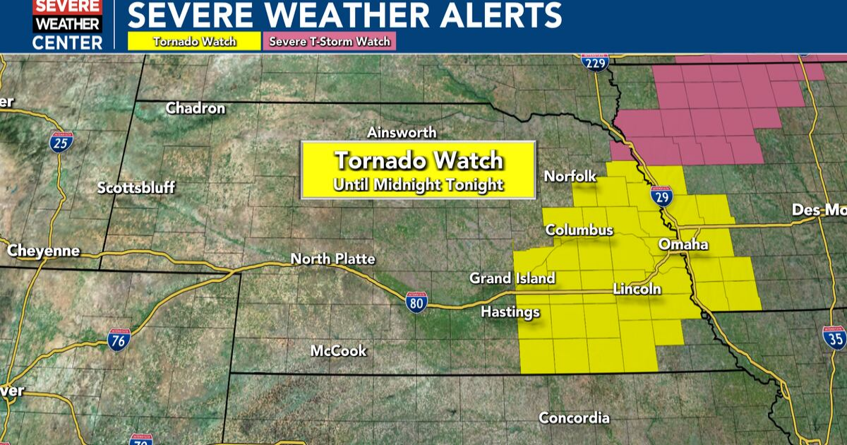
Tornado Watch in place for eastern Nebraska until midnight tonight
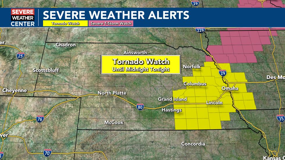
A Tornado Watch is in place for central and eastern Nebraska until midnight tonight.(KOLN)
The Storm Prediction Center has outlined much of eastern Nebraska with a slight and enhanced risk for severe storms – meaning scattered to numerous severe storms will be possible. Large hail – possibly as large as 2.0″ to 3.0″ in diameter will be the primary threat with storms this evening, but strong wind gusts of 60 to 70 MPH and a couple tornadoes could also be possible though as storms move east through the area tonight.

An enhanced risk for severe weather is in place across east central Nebraska into western Iowa for Thursday evening, where scattered to numerous severe storms will be possible.(KOLN)
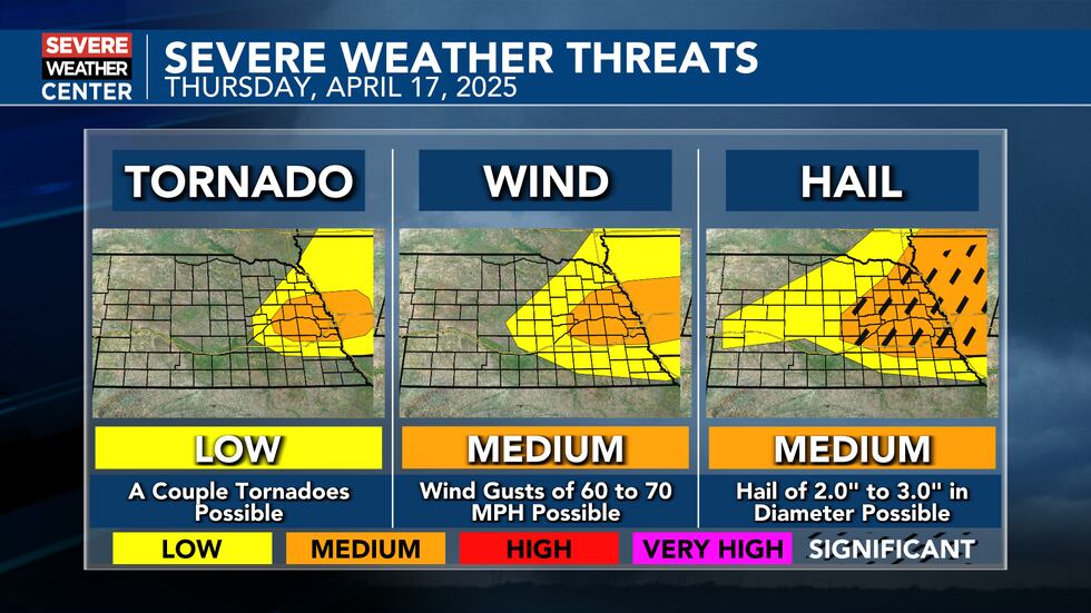
The main threat with severe storms into Thursday evening will be large hail, though strong winds and a couple tornadoes will also be possible across eastern Nebraska.(KOLN)
Storms are expected to develop along a slow moving cold front draped across parts of eastern Nebraska between about 4 and 6 PM this evening. Storms are then expected to move east off the front through eastern Nebraska and then over the border into western Iowa. Short term convective models keep most of this activity north of I-80 this evening, with the Lincoln and Omaha metro areas expected to be on the southern edge of possible storms. As a cluster or broken line of storms develops, they are expected to rapidly increase in intensity as the cap breaks. Of particular interest will be the southernmost storm along the line, as that one will have the potential to be the most intense with the largest hail and a tornado or two possible. Regardless of what short term model you look at, it appears that the main line of storms should move east of the area by about 9 to 10 PM tonight – so our window of severe potential is fairly narrow. While a good chunk of eastern Nebraska is at least under the threat for some severe weather this evening – by no means will everyone see storms or rain. In fact, many areas will likely see little or no activity through Thursday evening.

Storms are expected to fire along the cold front between 4 and 6 PM, with storms then moving east out of the area by mid to late evening.(KOLN)
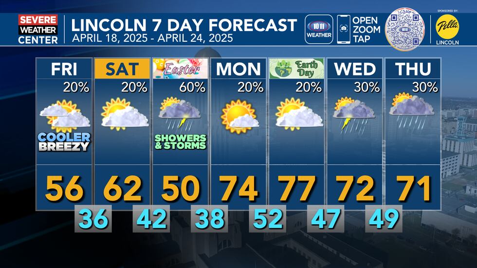
Behind the front, much cooler and breezy conditions are expected into the day on Friday. Look for fairly overcast skies through most of the day with a blustery north wind at 15 to 25 MPH that will gust between 30 and 40 MPH at times through the day. We could see a spotty shower or two on Friday, but most of the state will remain dry to finish the work week.

Look for mostly cloudy, cool, and blustery conditions across the state on Friday with some scattered light rain showers possible at times.(KOLN)
After seeing highs well into the 80s to near 90° on Thursday, temperatures will tumble behind the front on Friday with high temperatures in the afternoon only reaching 50s for central and eastern Nebraska, with highs only reaching the 40s in the far west on Friday afternoon.

Temperatures will only reach the 40s and 50s on Friday with overcast skies.(KOLN)
Into the Easter weekend, temperatures should rebound a few degrees on Saturday with a mix of sun and clouds, but more clouds and chances for rain will lead to a cooler day on Easter Sunday.
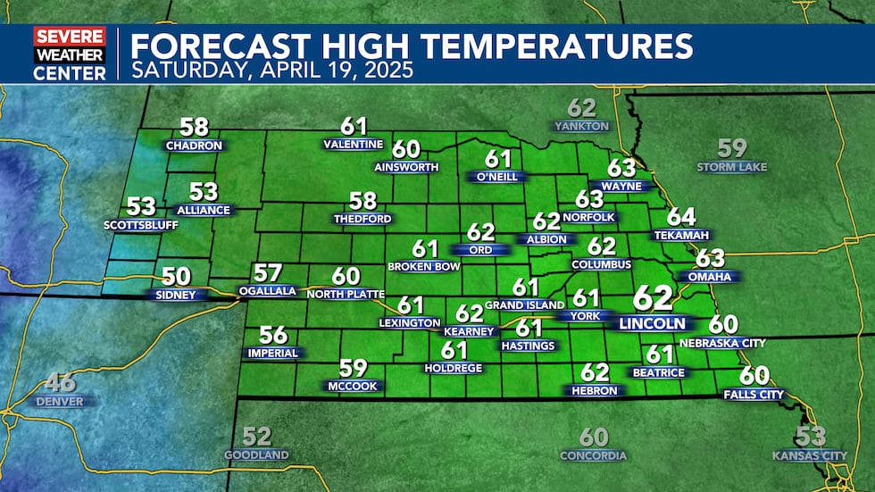
Look for highs in the low 50s to low 60s on Saturday.(KOLN)
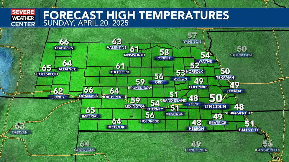
Well below average temperatures are forecast for Easter Sunday across eastern Nebraska.(KOLN)
While off and on rain looks possible through the day on Easter Sunday, the heaviest moisture looks like it will remain to our south and east where they could see several inches of moisture through the holiday. Make sure to check back with later forecasts as we continue to try and fine tune the forecast for the holiday weekend.
Overall, after a cooler weekend, warmer temperatures return to the area through most of the week next week with highs into the 70s for most of the week next week. We’ll keep an eye on some small rain chances for Tuesday and Wednesday, before slightly better chances return by Thursday of next week.
Temperatures stay below normal through the holiday weekend with warmer temperatures returning next week. Off and on rain chances are expected for the next week too.(KOLN)
Click here to subscribe to our 10/11 NOW daily digest and breaking news alerts delivered straight to your email inbox.
Copyright 2025 KOLN. All rights reserved.