Getty Images
The 2025 NFL Draft is here. Well not exactly here yet, but we’ve reached the ever-glorious Draft Day. This is when months of rampant rumors and sketchy speculation are triumphantly tossed out the window in favor of actual draft picks. We’ll soon have answers for the many oft-asked questions about this very mysterious 2025 draft. .
As we collectively count down the hours until the Titans officially go on the clock, let’s do one more prediction. Here are some last-minute bold predictions for the first round of the draft.
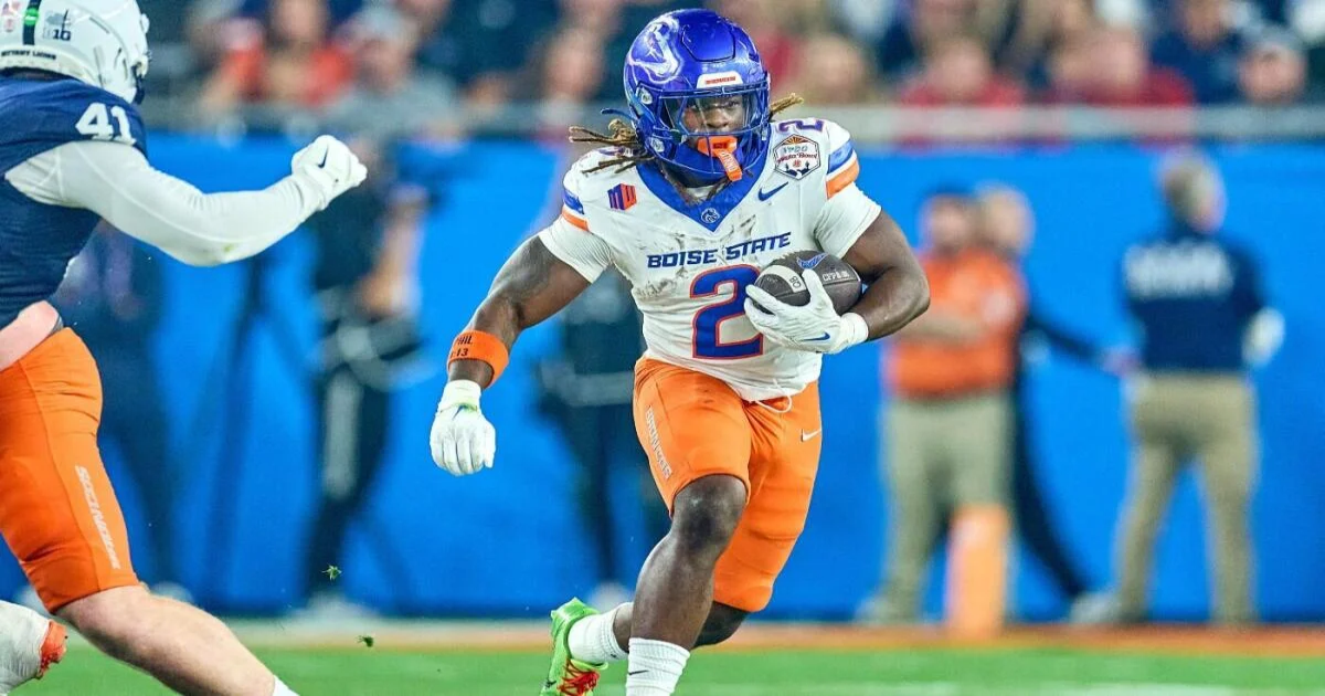
The Bears trade up for Ashton Jeanty
Ben Johnson apparently loves running backs. Or, I guess, he loved designing plays that featured a young, freaky-explosive runner in Detroit — Jahmyr Gibbs. And Jeanty is one of the select few “blue-chip” prospects in this class who’d directly impact Chicago’s offense in Year 2 of the Caleb Williams era and make Johnson an even happier man.
Jeanty is not going to be available at No. 10 overall. The Bears have four Top 72 selections. The stars are aligned for GM Ryan Poles — who’s reasonably on the hot seat — to make an ascension into the Top 7, or Top 5 to pick this explosive runner with the best contact balance I’ve ever scouted.
Of the four major books (DraftKings, FanDuel, BetMGM and Caesars), all of them now have Boise State running back Ashton Jeanty as the favorite to be selected fifth overall (as of Wednesday morning).
James Pearce is the second EDGE off the board
The supposed off-field red flags have overshadowed two incredibly productive seasons from Pearce in the SEC and a tremendous workout in Indianapolis at the combine. I’m not completely dismissing the widespread rumors. But they could be smoke. Crazier rumors have run rampant regarding specific prospects in the draft.
Pearce is a Charlotte, North Carolina native, so you better believe Panthers GM Dan Morgan has done his homework on the true background of Pearce from his time growing up in the backyard of the Panthers facilities.
Despite all the character questions about Pearce, he never served a suspension of any kind via the Tennessee program or the NCAA. In what would be a shocker after months painting Pearce as someone most teams will steer clear of in the first round but absolutely would address a glaring need at the edge-rusher position in Carolina.
No Omarion Hampton in the first round
This is probably my boldest prediction given how much buzz there is for the North Carolina to be a first-round pick. Could he go to Denver at No. 20 overall? Sure. Is he that good of a prospect for Sean Payton and Co. to trade up in Round 1 all for the second running back off the board in potentially the most loaded running back class since 2017?
I can’t see it happening. Sure, there’s the Jerry Jones-run Cowboys at No. 12. That organization represents a landing spot for Hampton too. But isn’t selecting a wide receiver to take attention off CeeDee Lamb more important? Like, way more important? And, heck, Dak Prescott isn’t exactly cheap anymore, so helping him with more receiving help as he enters his 30s would be significantly more sensible than picking the second running back in this draft.
Matthew Golden lands in Dallas with the Cowboys
More Cowboys! Can never have too much Cowboys, right? This is somewhat of a match made in heaven through the lens of Jerry Jones’ mind. Sure, he loves Arkansas prospects because he’s an alum — shout out to Felix Jones. But a receiver, from the University of Texas? In Round 1. Oh, and he ran 4.29 at the combine?
You could not add more perfect descriptors for Jerry. OK, so Golden may not be huge. But the first round is all about traits and that 40-yard dash time is the ultimate selling point to fans and coaches at the receiver position. Golden didn’t have first-round production until late in his final season at Texas but did average over four catches and nearly 82 yards per game in his last eight games for the Longhorns.
Vikings pick Tyler Booker
Before the combine, this wouldn’t have been considered bold whatsoever. Then Booker had a very low-caliber workout for the guard position. Yes, he’s massive. But even relative to his size, it was concerning across the board.
I envision this happening after a slight trade back by Minnesota, a club that enters tonight with just four draft picks. And for as much of an analytics-forward front office GM Kwesi Adofo-Mensah has created that would likely suggest Booker is too risky for Round 1, the Vikings simply need to get a touch nastier in the trenches. If you don’t believe me, rewatch their wild-card playoff loss to the Rams. Los Angeles physically overwhelmed the Vikings all game.
Booker, next to Christian Darrisaw and newly acquired Ryan Kelly would formulate a rather large left-side trio at the start of the J.J. McCarthy era. For this pick, forget the combine workout for the Alabama masher.