ATLANTA — We’re gearing up for a multi-day severe weather outbreak Friday through the weekend with damaging straight-line winds, strong, long-track tornadoes and large hail.
Storms Friday led to tornadoes and wind damage across the southeast.
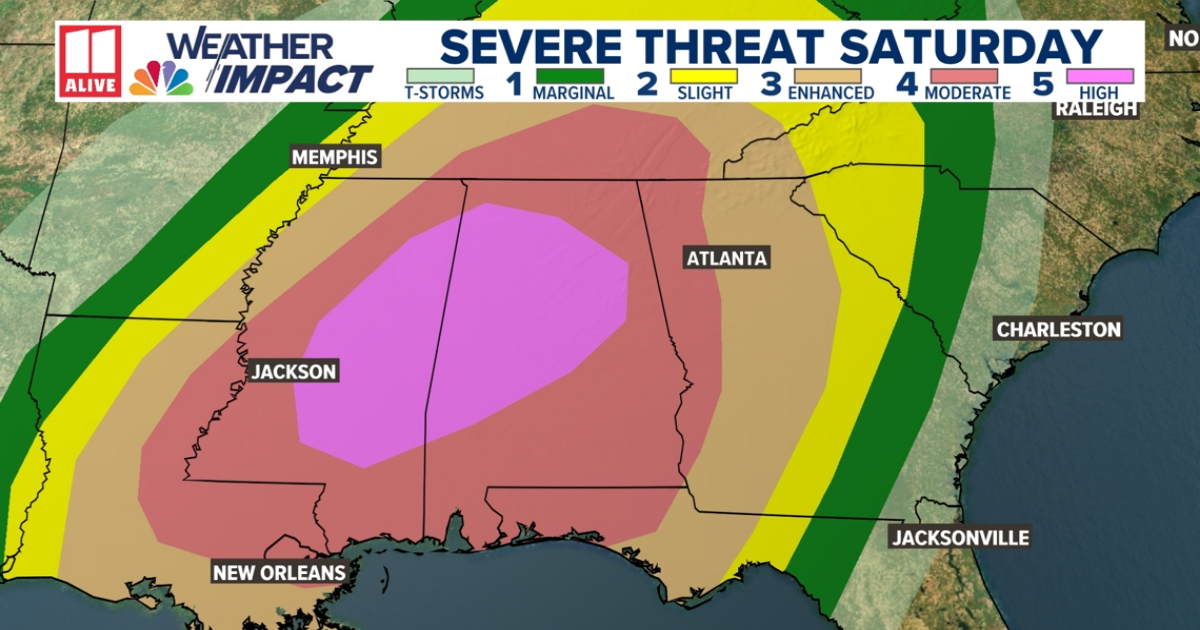
On Saturday afternoon, another volatile round of storms develops across the southeast, spreading severe weather from Louisiana, Mississippi and Alabama northward through the Ohio Valley.
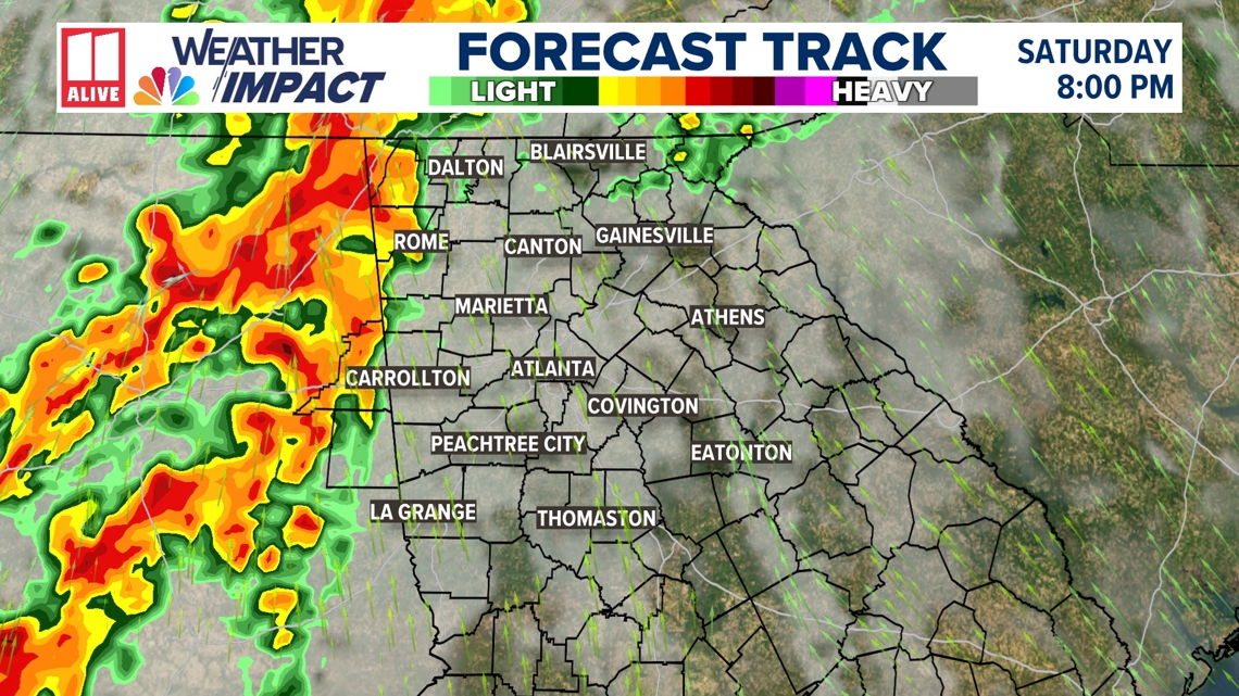
The storms that develop to our west Saturday afternoon across the deep south will be very dangerous. Several strong and possibly long-track tornadoes are possible within the Level 4 risk area. By sunset, the storms will near the Georgia-Alabama state line, then continue through north Georgia Saturday evening and overnight.
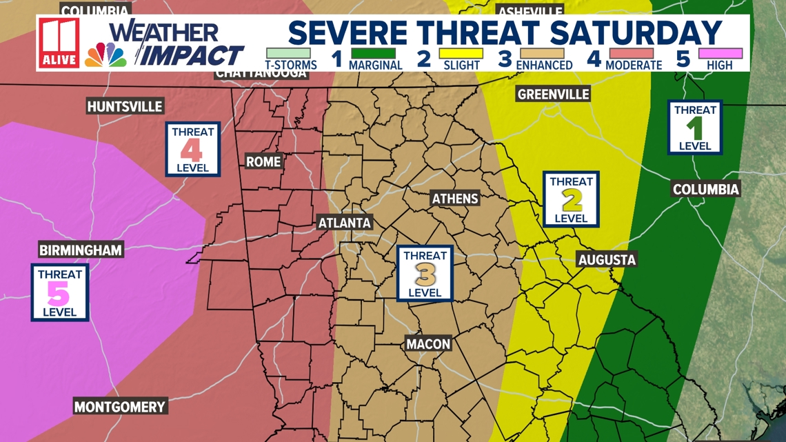
Portions of north Georgia are included in a level 4 out of 5 ‘moderate’ risk for severe weather, and the remainder of the 11Alive viewing area is in a level 3 out of 5 ‘enhanced’ risk.

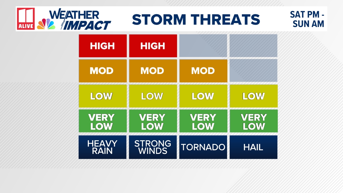
We could see numerous severe thunderstorms with strong straight-line winds of 60 to 70+ mph, strong tornadoes, very heavy rain, and 1″ to 2″ hail.
We’ve issued a Weather Impact Alert due to the magnitude and large area that strong and severe thunderstorms could potentially impact over the weekend.
Straight-line winds will be our most widespread severe weather threat, with some wind gusts around 70 mph possible. The tornado threat will be greatest across western Georgia and should become slightly less favorable later overnight as we lose some of the instability in eastern Georgia.
Heavy rainfall will also be widespread. Rain totals could reach two to three inches in spots, creating a localized flash flooding possibility.

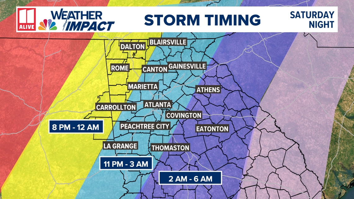
The greatest risk of severe weather will come during the evening and overnight, first arriving in northwest Georgia. Here is a rough window for when we anticipate the widespread storms to enter your part of Georgia. Storms can also happen outside that window. We go through a more detailed timeline below.

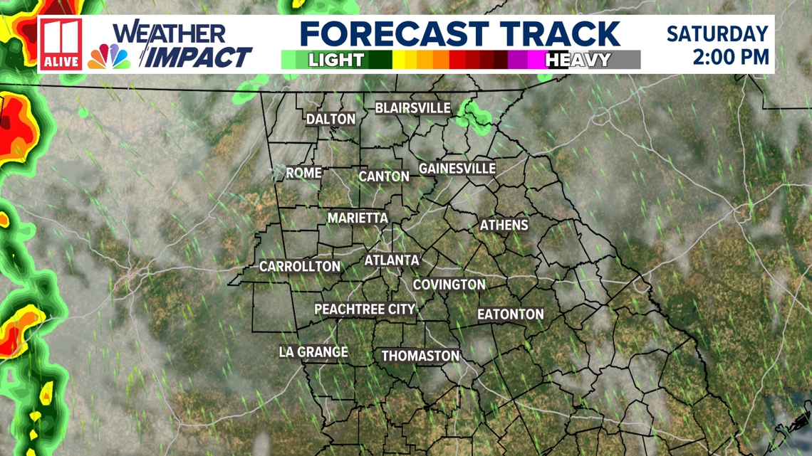
Once the morning rain in NW GA clears, the remainder of the day is mainly dry. The afternoon hours on Saturday may catch you off guard. It will be windy at times but otherwise remarkably pleasant. Temperatures will reach the upper 70s, with a mix of clouds and sunshine.
Don’t let your guard down. Storms are coming in the evening and overnight. Stay informed of the timeline and any watches that may be put into place late in the day.

The main line of storms arrives in NW GA Saturday evening, likely after sunset.

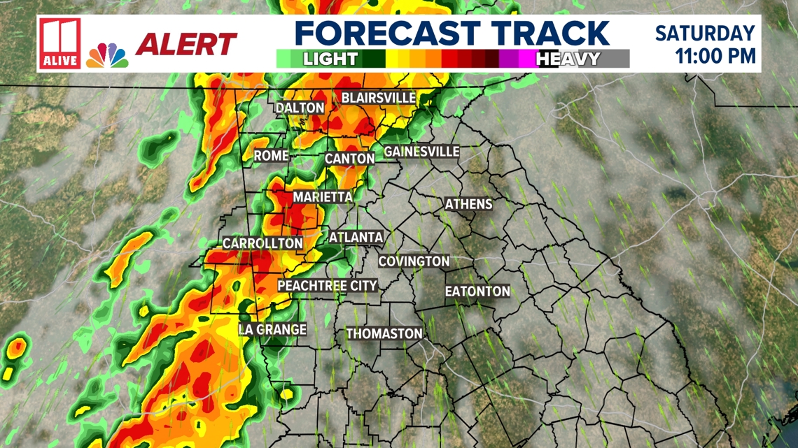
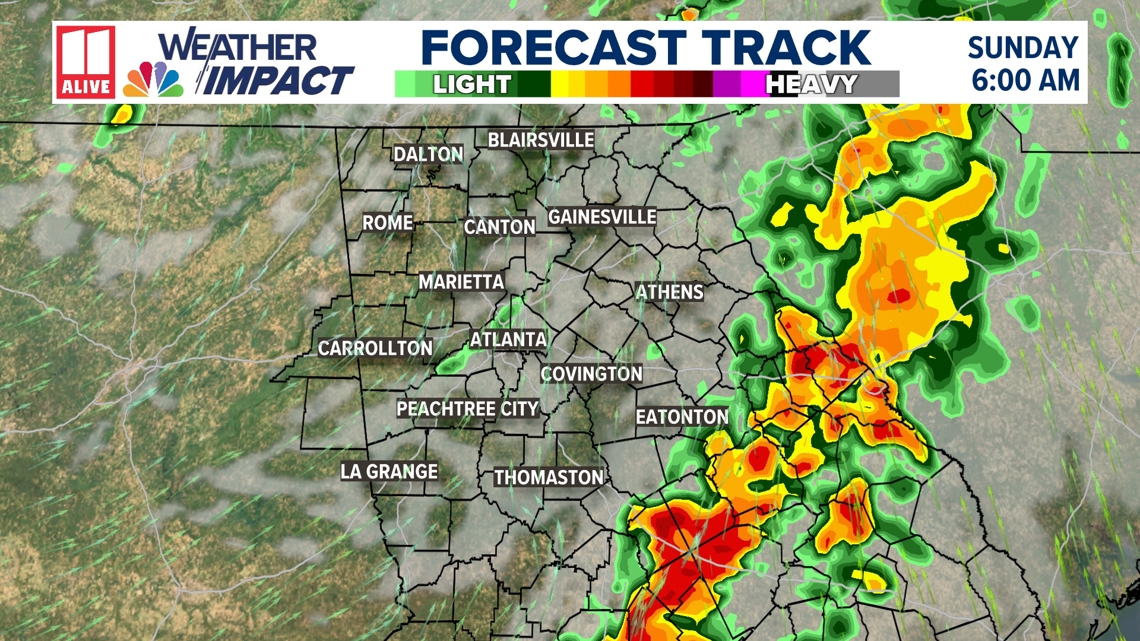
Storms spread into the Atlanta metro around midnight. This will be mainly a late evening and overnight event, so you must have a way to get alerts that will wake you if needed.

The line of storms will continue to push southeast through the night.

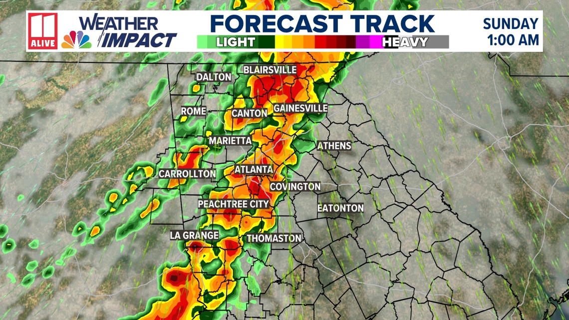


A few showers and storms may linger behind the main line, but by sunrise, the bulk of the activity will be over.

- Know your county of residence and how to find it on a map
- Know your ‘safe place’ to go if you are placed in a tornado warning polygon Saturday evening and overnight
- Communicate with your family and friends to make sure they’re aware of the incoming severe weather
- Ensure you have more than one way to receive severe weather warnings. Outdoor sirens do not count. Download the 11Alive App and turn on weather notifications, enable ‘wireless emergency alerts’ in the settings section of your phone, or get an NOAA weather radio.