LUBBOCK, Texas — I knew Friday’s storm chase would be a wild one, but what I saw was still mind-boggling.
Parts of the Texas and Oklahoma’s High Plains were hit with a barrage of tornado-producing supercells on Thursday. The rotating thunderstorms unleashed giant hail (up to 5.2 inches across) and tornadoes, including a rare one that spun the wrong way (clockwise) northeast of Lubbock.
Early reports suggest little to no damage, with slow-moving storms remaining largely over rural areas. It was a dream scenario for hundreds of storm chasers and scientists. Researchers from the University of Oklahoma and Texas Tech were in the field with mobile radar units capturing close-range datasets.
I tracked down the storms, too, dodging giant hail and scoring three close-range tornado intercepts. Here were some highlights:
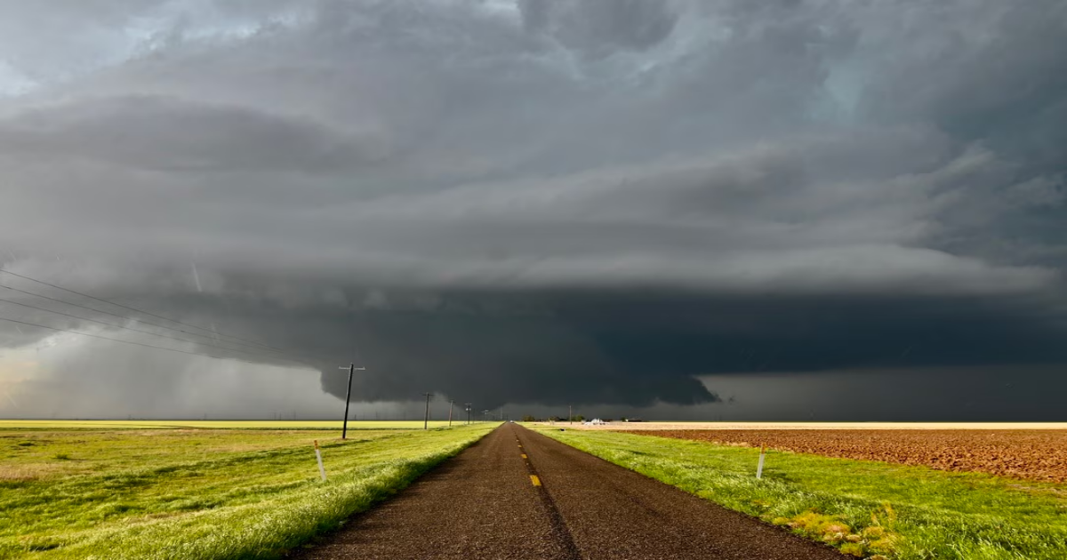
Thunderstorms erupted along a dryline during the midafternoon hours. That’s the clash between bone-dry air from the Desert Southwest and moisture-rich Gulf air to the east. Changing winds with height sculpted them into rotating supercells.
What helped them overachieve was something called an outflow boundary, or the leading edge of cool air exhaust from the prior day’s storms. That boundary brought moist low-level flow and switched surface winds around out of the southeast. Those surface winds contrasted against west-southwest upper-level flow, boosting the amount of spin.
One lone supercell formed near the Caprock Escarpment southeast of Amarillo, producing rain and hail near Silverton by 6 p.m. That’s when something magical happened.
About 99 percent of tornadoes in the northern hemisphere spin counterclockwise. And of that 1 percent of so-called anticyclonic tornadoes that spin clockwise, they’re rarely significant.
But the first tornado dropped by the Silverton supercell was just that. The storm itself was spinning counterclockwise. How it produced a clockwise tornado is unclear.
Perhaps it was an unusual or chaotic interaction caused by a rain shower merging into the main storms back side. Or possibly the storm ingested spin from the nearby boundary in a topsy-turvy sort of way.
In either case, the tornado lasted seven minutes, spun clockwise and danced elegantly over open fields.
Around 7:11 p.m., the same storm produced what appeared to be a strong to violent tornado northwest of Matador, Texas.
Most other storm chasers had flocked east, but I took a gamble — one that required patience and clever navigation — and diverted far south.
I had a hunch the storm would make a right, or southward, turn, and I wanted to be on a paved road.
I had careened north on FM28, basking in sunshine while watching the massive tornado plant itself on the ground barely a half mile in front of me.
The same storm was dropping DVD-size hail — 5.2 inches in diameter — at the time.
It also appears the storm produced multiple additional tornadoes just west of Matador and Roaring Springs, Texas.
Around sunset, I blasted south to a new supercell near Post, Texas. It stalled in a remote landscape, averting any structural damage.
But by that point, it was carouseling. That’s the term storm chasers give to a storm that has several couplets of rotation orbiting one another or moving in deviant ways.
The scientific term is the Fujiwhara effect.
Storm chaser reports indicate three tornadoes were on the ground simultaneously.
I witnessed a stout tornado illuminated by lightning flashes northeast of Post. But once deviant motion ensued and tornadoes began wrapping in rain, I bailed west.
There were other storms too. One in northwest Oklahoma produced a picturesque tornado near the town of Freedom. And there was a brief tornado near Omaha.
The town of Miami, in the Texas Panhandle, narrowly missed being brushed with a strong tornado around nightfall, but it fortunately lifted before the circulation arrived into town.
Meanwhile, more tornadic supercells are possible Friday and Saturday.
Storm chasers will be out again in full force, working to get a front-row seat to witness Mother Nature’s most extreme.