CHARLOTTE, N.C. (WBTV) – Today will start with low clouds and even a little, patchy drizzle before clouds break for some sunshine featuring gusty winds and warm with highs well into the 70s.
- Today: Breezy & warm, few spotty showers
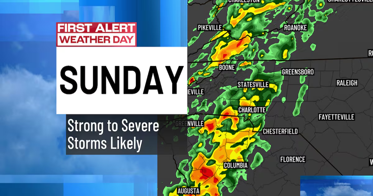
- Sunday: First Alert Weather Day: AM Strong to Severe Storms
As a strong area of low pressure and a slow-moving cold front heads our way this weekend, heavy downpours and severe weather will be on the rise late Saturday night through Sunday morning.
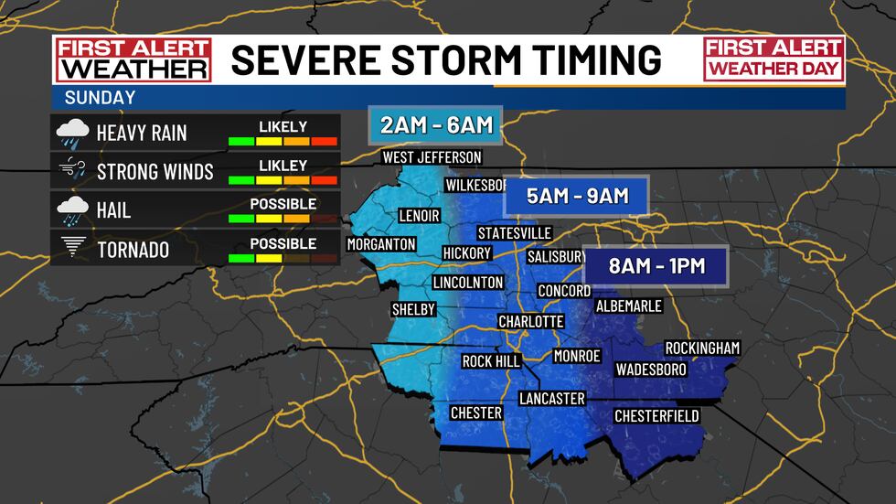
Severe storm timing(First Alert Weather)
Sunday is a First Alert Weather Day as heavy rain, damaging winds, large hail, and even a few tornadoes are in the forecast early in the day.
In advance of the storm, take the time to secure loose objects outside your home, charge up your mobile devices, download the free WBTV Weather app and have notifications turned on and the volume turned when you go to bed Saturday night.
Please pay attention to Sunday’s forecast and check back with the WBTV First Alert Weather Team for forecast updates.
Beyond Sunday’s front we’ll clear out and cool off a bit Monday with highs in the 60s before warming back up into the 70s midweek.
Download the free WBTV Weather app on your mobile device, to receive weather alerts and get your latest WBTV weather forecast on the go. You can also get the latest weather forecast on Roku and Amazon Fire’s WBTV app.
Eric Garlick
Copyright 2025 WBTV. All rights reserved.