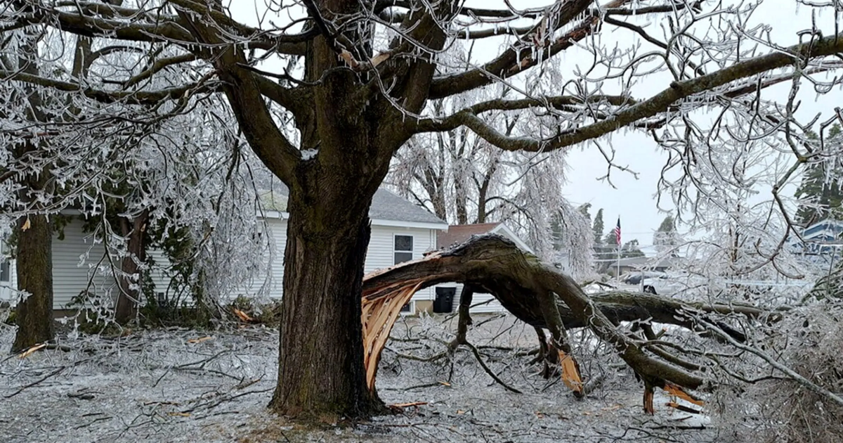
Just days after an ice storm hit portions of northern Michigan and knocked out power to thousands of residents, the state is once again facing the potential for severe weather.
The western portion of the state is forecast to see snow that will transition to rain with a period of freezing rain, which will end by the afternoon, according to the National Weather Service office in Grand Rapids.
Showers and severe storms are possible through the afternoon and evening, with damaging winds up to 70 mph, localized flooding, large hail and tornadoes all possible, according to the NWS. The highest risk is between 3 p.m. and 11 p.m. local time, with the highest risk being areas along I-94 and southward.
In the northern part of the state, 1-2 inches of snow are expected in most areas before changing to freezing rain or regular rain, according to the NWS office in Gaylord. Additionally, strong east winds with gusts up to 35-40 mph are possible early Wednesday morning into Wednesday evening, with winds remaining elevated into Thursday.
Thunderstorms are also possible in the area Wednesday, with “a strong storm or two” not ruled out, the NWS said Wednesday. Flooding is also a concern for the Manistee River near Sherman and the Rifle River near Sterling, according to the weather service.
As for eastern Michigan, the NWS office in Detroit says there is an enhanced risk for severe weather over southeastern Michigan into Wednesday evening.
“Damaging wind and heavy rainfall will be the main threats along with a risk of tornadoes,” the NWS in Detroit said Wednesday. “Stay weather aware today, have multiple ways to receive warnings, and be ready to act if a warning is issued.”
Additionally, a flood watch is in effect for portions of southeast Michigan from 8 p.m. Wednesday to 8 a.m. Thursday, including all of Metro Detroit, Ann Arbor, Port Huron, Adrian and Monroe, according to the NWS, as 1-2 inches of rainfall is expected as “several rounds of heavy showers and thunderstorms move through the area.”
The NWS also said a winter weather advisory is in effect for the Tri Cities and northern Thumb regions Wednesday morning as snow transitions to freezing rain and eventually all rain by mid-morning, with snow accumulations of up to two inches expected and ice accumulation of up to a tenth of an inch.
Weather: A dire forecast in central US this week: You’ve never seen rain like this
Ice storm caused power outages in Michigan last weekend
Large portions of northern Michigan were without power due to an ice storm that hit the area on Saturday.
The National Weather Service office in Gaylord, Michigan said on X Sunday morning ice accumulations at its office ranged from a half inch to nearly an inch.
As of 10 a.m. ET Wednesday morning, over 120,000 homes and businesses were still without power across the state, according to a USA TODAY power outage tracker. Most of the outages are in the northern portion of the state.
Great Lakes Energy said in an update Wednesday morning that roughly 35,000 of its customers are will without power, as storm damage left many roads impassable and caused “extensive harm to power infrastructure, slowing the restoration process.”
Gabe Hauari is a national trending news reporter at USA TODAY. You can follow him on X @GabeHauari or email him at [email protected].
