Severe thunderstorm watch issued for parts of western Washington
![]()
SEATTLE — Strong, widespread thunderstorms are forecast in western Washington Wednesday afternoon through Wednesday night.
Dangerous lightning and heavy downpours that lead to short-term urban flooding are likely, according to KOMO News Chief Meteorologist Shannon O’Donnell. Unusually large hail – potentially above quarter-sized – along with bursts of damaging wind or even an isolated tornado are also possible with this storm.
The National Weather Service issued a severe thunderstorm watch for parts of western Washington through 9 p.m. Wednesday. The watch includes King, Pierce, Lewis and Thurston counties.
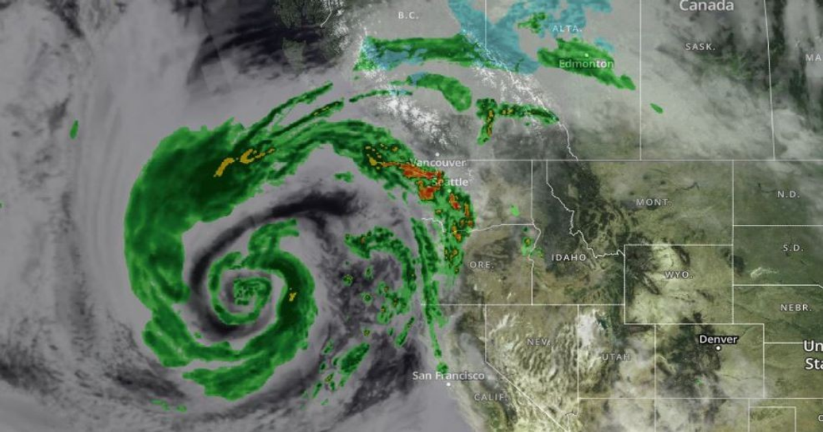
The storm system is forecast to reach the Oregon-Washington border around 5 p.m. Wednesday. A broken line of thunderstorms is expected to build, first pushing through the Chehalis Valley into Long Beach around 6 p.m.
Storms are forecast to get stronger and push into the Aberdeen – Olympia area between 6-8 p.m.. It’s then forecast to move into Tacoma, Seattle and Forks between 6-9 p.m. Through 10-11 p.m., the storm system is expected to push north over the San Juan Islands and Bellingham as they lose a little steam.
A severe thunderstorm watch means “conditions are favorable for hazards to occur,” the NWS said. A severe thunderstorm warning is issued when a severe thunderstorm is “happening or about to happen.” In the event of severe weather warnings, be prepared to seek shelter in the most interior part of a building, ideally a basement, and away from windows, O’Donnell said.
According to the Storm Prediction Center, this is the first time Seattle and King County have been included in a severe thunderstorm watch since June 1999. A severe thunderstorm watch was last issued for Pierce, Lewis and Thurston counties in May 2017.
While there are other risks associated with this storm system, the NWS said large hail is the “primary hazard” from Wednesday’s thunderstorms. The weather service said if large hail begins to fall while you’re driving, stay in your vehicle and slowdown or pull over and stop in a safe location.
If you have access to a parking garage, park your car inside to protect your vehicle and prevent hail damage. The Bellevue Police Department said anyone with a parking garage should consider parking at a public garage like the Eastgate or South Bellevue park and ride garages.
The NWS said there were reports of “some lightning strikes” from storm cells moving up from the south into King County around 2:15 p.m. Wednesday.
A secondary wave of steady rain and gusty wind will roll in by Thursday.
Stay with KOMO News for updates during severe weather by downloading our app and following us on X, Facebook, Instagram, and TikTok. You can also share your storm photos with us on Chime In.
Click here to see the full forecast for western Washington.