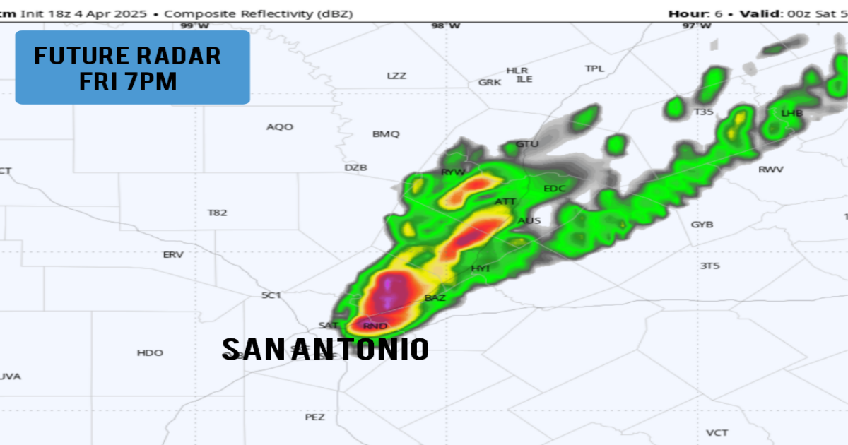
Future weather radar modeling for 7 p.m. Friday, according to the HRRR weather model, shows isolated strong to severe storms are expected to develop.
WeatherBell
The chance of scattered severe thunderstorms is increasing across parts of Central and South Texas on Friday evening. Two distinct rounds of storms are expected: one this evening and another one during the overnight hours.
First round of storms: For the evening round of storms, the area of greatest concern is right along the Interstate 35 corridor, including Round Rock, Austin, San Marcos, New Braunfels and San Antonio.
Scattered thunderstorms are expected to develop along a stalled cold front just to the west of I-35. Storms are not expected to be widespread, so not everyone will experience severe weather. However, the storms that do develop could intensify quickly and produce damaging hail and wind gusts.
Article continues below this ad
Shown is the expected location and timing for the first round of storms in South and Central Texas Friday evening.
nws austin/san antonio
Storm chances along this particular front will be highest between 5 and 10 p.m. San Antonio’s chance of storms is about 30% during this time.
The strongest storms could produce hail as large as baseballs and 70-mph winds. A small threat of tornadoes persists, but the overall chance of tornado formation is low.
The tornado threat is a bit higher northeast of San Antonio. That is why a tornado watch has been issued for much of East Central and Northeast Texas until 9 p.m. This includes cities such as College Station, Huntsville, Corsicana, Tyler, Lufkin and Texarkana.
Article continues below this ad
Shown is the expected timing for the second round of storms in South and Central Texas overnight into Saturday morning.
nws austin/san antonio
Second round of storms: More thunderstorms are expected overnight across South Texas, especially between 1 and 7 a.m. Saturday. Severe weather, including large hail and damaging winds, is possible with this activity as well. The highest chances of severe weather will be across the Hill Country, but chances do still exist in the San Antonio metro area.
If a severe thunderstorm warning is issued for your area, take shelter immediately and stay away from windows.
